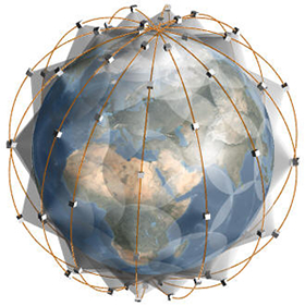
Satellite constellation for remote sensing with medium resolution and fast data acquisition (with rapid deployment)
The project is aimed at solving problems of Russia's access to live satellite data, including satellite imagery of the planet surface in visual-light and infrared wavelengths.
Today Russia doesn't have an independent system providing medium-resolution data fast enough.
- Resurs-DK1 spacecraft (developed by JSC SRC Progress) is operating beyond the expected lifetime.
- Resurs-P spacecraft (developed by JSC SRC Progress).
- Meteor-M spacecraft (developed by VNIIEM Corporation) is operating with restrictions due to on-board equipment defects.
- Elektro-L #1 spacecraft (developed by NPO Lavochkin) is a low-resolution meteorological satellite operating in geostationary orbit, it is unable to monitor the polar regions. Out of service.
- Kanopus-V #1 (developed by VNIIEM Corporation).
MKA-FKI (PN1) Zond-PP spacecraft is a Russian remote sensing smallsat developed by NPO Lavochkin, ceased operation as of today.
Kondor spacecraft provides data only in microwave part of the spectrum.
Russian orbital group of satellites also includes spacecraft of ballistic missile early warning system and military optical reconnaissance satellites, but obtaining photographs from military satellites is extremely difficult for civilian users.
Therefore, Russian organizations and individuals practically don't have an opportunity to get medium-resolution satellite data fast enough.
The majority of domestic users and organizations currently have to buy photographs provided by western satellite operators. It should be emphasized that the provision of such information takes weeks or even months. This situation is unacceptable when dealing with such tasks as tracking illegal logging, monitoring ice conditions or forest fires. It is worth noting that for protecting the global strategic interests of Russia information gathered not only from the national territory, but from other regions of the globe is needed.
Solution and innovation of the approach
The problem of Russia's fast access to medium-resolution satellite information is solved in this project with the deployment of a satellite constellation of a new type with a large number of small spacecraft. The use of a highly inclined sun-synchronous orbit allows to cover the polar regions of the planet.
Innovation of the approach:
- Instead of a single heavy remote sensing satellite, a "cloud" of 28 light microsats (up to 100 kg) is proposed for use. Significant cost reductions are achieved due to such factors as:
- Unification of the constellation satellites - the same production and test base is employed for the creation and testing of all the satellites. Control algorithms, tested on a single satellite of the series, are used for all the satellites of the constellation.
- Mass-produced electronics (military grade) is used in the microsatellites.
- The entire satellite constellation can be launched by a single microsat launch vehicle, as well as through multiple launches as secondary payloads. This approach allows to reduce costs of the system deployment and improves the general reliability of launching the constellation into space. It's worth noting that the second option (as a secondary payload) requires choosing the launch time such that all the satellites of the constellation be launched in the same or close orbital planes. If that's not possible then the configuration may be reconsidered.
- Laser communications are to be employed for transmitting information in the following directions:
- satellite — satellite;
- satellite — ground — satellite.
Therefore, fast data acquisition is ensured — satellites moving below the horizon can relay the necessary data to each other within seconds.
The proposed method of laser communication with orbital constellation considerably reduces the number of receiving stations on the ground, thus lowering the total cost of the satellite constellation. Moreover, satellite-satellite laser communication allows to control each satellite regardless of its location in orbit.
Plasma thrusters of SPD-35 type by Fakel Experimental Design Bureau are proposed for placing individual satellites in orbit.
Employing electric thrusters with small thrust ensures high delta-v budget for each spacecraft, allowing a flexible approach when choosing the orbital parameters.
Employing plasma thrusters allows to use the satellite platform (after upgrade) for missions to Solar System bodies, such as the Moon and near-Earth asteroids.
- High fault-tolerance of the system is ensured by:
- employing a large number of satellites - a loss of one, two, three, four and more satellites will not result in failure of the entire system, it will be able to function;
- using a special layout of spacecraft for radiation protection, and special algorithms;
- providing backups for key functionality both in software and hardware.
Therefore the satellite constellation can withstand both cosmic radiation and the use of possible weapons by a potential enemy.
Basic technology description
The satellite constellation consists of 28 light (up to 100 kg) microsatellites.
- Each spacecraft is based on microsat platform of our own design, consisting of the following components:
- Electro-optical equipment — lens with electronic sensor for image capture.
- Laser communication system for information transmission in the following directions: satellite to satellite, satellite to ground, ground to satellite. Therefore fast data acquisition is ensured - satellites moving below the horizon can relay the necessary data to each other within seconds. The proposed method of laser communication with orbital constellation considerably reduces the number of receiving stations on the ground, thus lowering the total cost of the satellite constellation. Moreover, satellite-satellite laser communication allows to control each satellite regardless of its location in orbit. In the first phase of the project the number of required receiving ground stations needs to be specified.
- Onboard power supply system.
- Onboard computer.
- Plasma thrusters of SPD-35 type by Fakel Experimental Design Bureau are to be used for placing individual satellites in orbit. Employing electric thrusters with small thrust ensures high delta-v budget for each spacecraft, allowing a flexible approach when choosing the orbital parameters. Employing plasma thrusters allows to use the satellite platform (after upgrade) for missions to Solar System bodies, such as the Moon and near-Earth asteroids.
- Unification of the spacecraft will be performed to reduce costs - when creating and testing all the spacecraft, the same manufacturing and testing equipment is to be used. Control algorithms, tested on one spacecraft from the series, are used in all spacecraft of the constellation. To create the microsats, mass-produced commercial electronics will be used (Military grade).
- Launch of the entire satellite constellation can be performed both by a single small-lift launch vehicle, and as secondary payloads on multiple launch vehicles. This approach allows to reduce the costs of the constellation deployment and improves overall reliability of launching the constellation into space.
- A sun-synchronous orbit will be used to improve power supply conditions for the satellites, and to cover the polar regions.
Technology and market trends in the industry
Today in satellite engineering the transition has virtually completed from heavy pressurized spacecraft operating a few years to unpressurized spacecraft with a lifetime of more than 10 years. These spacecraft have modern electronics, allowing to assign the control functions to onboard computer and considerably relieve the load on ground-based mission control centers.
A trend for reduction of spacecraft mass is also seen, due to the use of advanced electronics and new control algorithms and software.
It's noteworthy that small companies are unable to create and operate heavy satellites, and the solution is to make spacecraft smaller and cheaper by using advanced electronic components when creating the microsats.
But the space is a hostile environment, and the mass of onboard computer can not always be reduced, since the requirements to the electronic components become more stringent. Early successes are already seen today — Russian MKA-FKI (PN1) Zond-PP spacecraft have worked successfully in orbit.
The market trends towards fast provision of information from remote sensing satellite constellation on demand of a customer.
The market of satellite imaging is growing fast. Launch of satellites by private companies and selling the imagery resulted in the creation of market for commercial remote sensing data with all its features. When talking about the market segment concerning satellite imagery, some things should be noted. First, the very fact of launching new satellites indicates positive assessment by the companies of the market prospects for distribution of such information. Second, the progress is undeniable in the development of optical-electronic systems, ensuring the quality of obtained information, comparable to the quality of film photography. Third, some demands of the society appear, which can be met only by the satellite imagery.
Using the satellite imagery allows the customers to create not only generalized maps and plans, e.g. plans for land use, forestlands etc., but also to develop detailed plans for settlements, industrial objects etc. with different levels of detail.
Therefore, there are good prospects for the expansion of the market of satellite imagery of medium resolution, obtained through remote sensing satellites.